AI-POWERED TREE SELECTION & LAND PLANNING

Plant the right tree .
Grow a better tomorrow.

A location-first social travel experience designed for discovery, storytelling, and community.
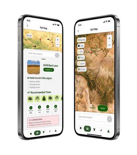
GPS soil insights
Tree recommendations

Project Overview

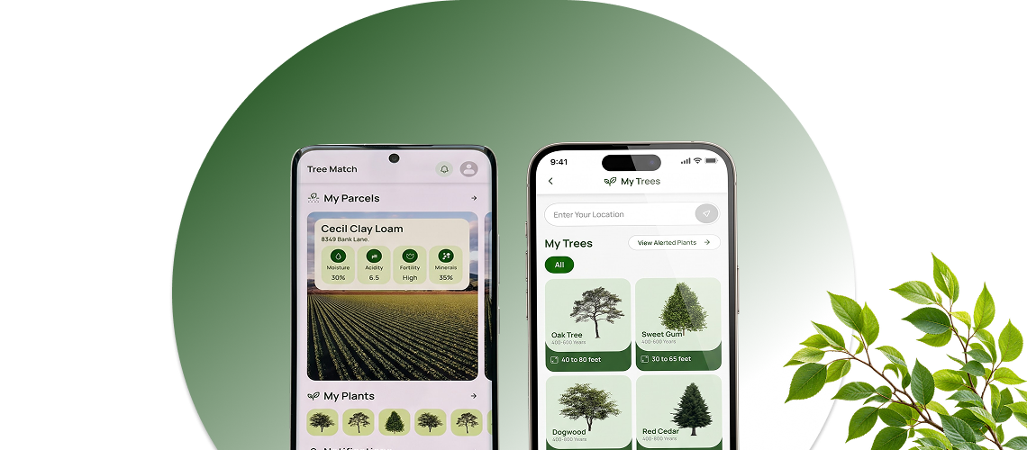
TreeMatch is a proposed Android and iOS mobile app that connects soil, climate and tree-species information to practical planting decisions. Rather than asking users to interpret fragmented maps and technical horticultural resources.
Who It serves

Home Owners

Land Owners

Small-scale farmer

Arborists

Environmental Advocates

Problem to opportunity

The Business Challenge

For property owners managing several plots, the challenge grows: recommendations must be tied to individual locations, planting choices need to be recorded, and seasonal care requires consistent follow-through.

What affects long term suitability

The Information Gap

Fragmented inputs

Distributed across specialist databases, mapping services, and general-purpose gardening websites.
One guided decision

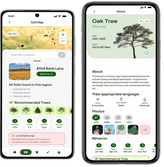
Tree Match brings that information into a location-specific, user-friendly recommendation and planning experience.
The Solution

The Solution: Location Intelligence Meets Practical Guidance.

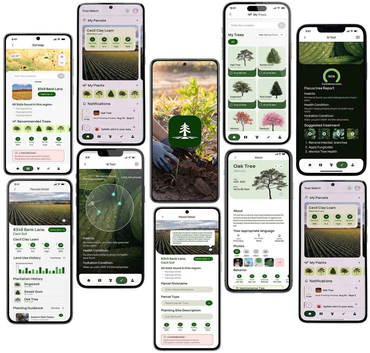
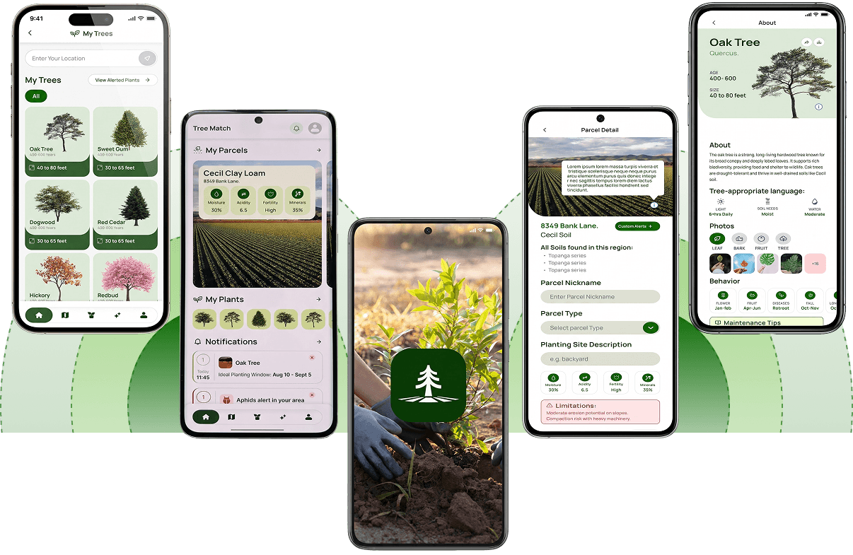
At the center of the experience is an interactive, GPS-enabled soil map. Users can identify their current location, enter an address, or drop a pin to explore a specific parcel. Dynamic overlays are designed to display soil classifications and relevant characteristics such as drainage, organic matter, fertility, and pH. Satellite, terrain, and soil views offer complementary perspectives.
Proposed integrations include SoilGrids or USDA NRCS SSURGO data, climate services, USDA hardiness zones, and curated species information; final providers and geographic coverage depend on integration validation.

Recommendations informed by the land.

Tree Match translates those inputs into tree suggestions informed by local soil conditions, climate zones, and user goals. Filters for growth speed, water needs, maintenance, native status, wildlife support, and expected size make discovery more precise.
Detailed species profiles then explain ideal growing conditions, seasonal behavior, potential pests, dimensions, and care requirements helping users understand why a tree may fit their land, not merely which tree to select.

Problem to opportunity

From Recommendation to Planting Plan

A planting journey that continues

The app concept supports land planning and ongoing tree care, not only discovery

MY LAND / PLANTING MANAGEMENT

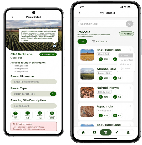
Save land parcels

Manage multiple garden, rural or community locations.

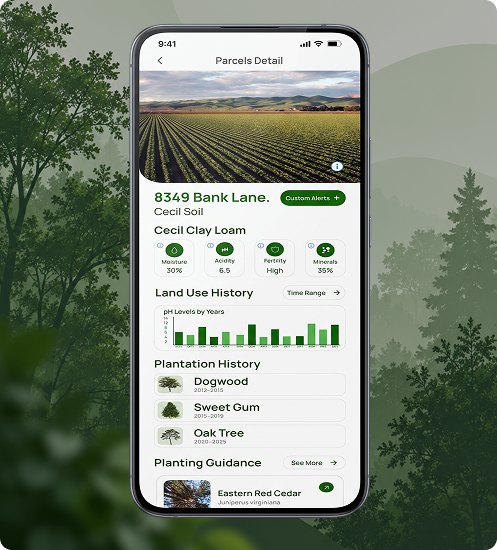
Record what was planted

Keep species, planting dates, notes and planting history.

Plant Seasonal Care

Frosts, pests, watering, pruning and favorable planting windows.

Keep plans accessible

Shareable PDF plans and selected resources for limited offline use.
THOUGHTFUL AI ASSISTANCE

AI Assistance with a Knowledge-Grounded Approach

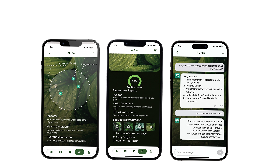
An AI chat assistant is designed to answer everyday questions in natural language, from selecting a shade tree to understanding yellowing leaves. Retrieval-Augmented Generation (RAG) provides the proposed foundation for more relevant responses: the system retrieves information from an approved tree encyclopedia, curated care articles, soil guidance, and other trusted references before generating an answer. This approach can improve traceability and keep guidance aligned with maintained content, while still requiring safeguards for uncertain or location-sensitive recommendations. 

AI ASSISTANCE / KNOWLEDGE-GROUNDED CONCEPT
“Which shade tree might suit my location?”
Consider your local soil, climate, planting goals and trusted reference guidance before choosing.
Proposed RAG approach: retrieve approved species, care and soil references first. Photo-based health diagnostics are planned for Phase 2, not a current capability.
FUTURE EXPLORATION / PHASE 2

Photo-based tree health diagnostics

Photo-based tree health diagnostics are explicitly positioned as a Phase 2 capability. The planned workflow would accept images of leaves, bark, or trees, identify possible symptoms, and provide confidence indicators, suggested next steps, and links to supporting resources. These outputs would assist preliminary assessment rather than replace an arborist or plant-health specialist.

COMMERCIAL MODEL

Monetization and Payments

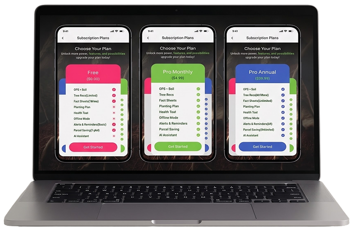
TreeMatch is designed around a freemium subscription model. Basic access includes core GPS soil discovery and limited tree lookup, while paid tiers can unlock expanded species research, advanced filters, multiple parcels, offline resources, and AI-enabled assistance. Stripe is included in the proposed payment architecture for eligible web-based billing or other permitted payment flows. Native in-app purchases through Apple’s App Store and Google Play are planned for digital subscriptions purchased inside the respective mobile apps, subject to platform rules. Entitlement synchronization and subscription administration help maintain a coherent experience across devices and channels.

User Experience and Delivery Priorities

A successful implementation would prioritize a clear onboarding journey, transparent location permissions, readable map legends, and straightforward transitions from soil discovery to species comparison and saved plans. Recommendation screens should distinguish measured environmental inputs from inferred suitability, and identify when underlying data is incomplete. During delivery, validation should focus on geospatial accuracy, regional coverage, recommendation quality, offline behavior, accessibility, and consistent subscription entitlements. The roadmap can sequence core mapping, encyclopedia, and parcel workflows ahead of advanced AI diagnostics, allowing user feedback to shape later releases. This disciplined approach keeps the product useful even before every envisioned feature becomes available.
FUTURE-READY PRODUCT

Designed for Responsible Growth

The platform concept balances approachable design with extensibility. Multilingual and accessibility support broaden usability; modular integrations allow soil and climate sources to evolve; and a structured content library makes recommendations easier to maintain. Potential later extensions include nursery connections, arborist partnerships, and community features. The specification also anticipates analytics for popular species, regional soil searches, engagement, and subscription trends, alongside consent management and data-export capabilities.
Foundation

Useful from day one

Soil and climate discovery , species knowledge planning records and accessible experiences.

Evolution

Smarter guidance

Maintainable references, AI assistance, modular data integrations, multilingual support.

Possibilities

Connected ecosystem

Potential nursery and arborist connections, community features, analytics and data rights.

VISION & OUTLOOK

Project Value and Outlook

Copyright © 2026 Powered by IT infonity | All rights reserved
✕
🎬

Demo Video In production, your actual product demo video would play here.
Embed a YouTube, Vimeo, or self-hosted video.

✕

Partner with IT Infonity for Business Success!

Our product experts will walk you through a personalized demo and help you find the perfect solution for your needs.

📅
30-minute focused session
🎯
Tailored to your industry
💡
Live Q&A with our experts
💰
Free — no credit card needed
⚡
Confirmation within 2 hours

Book Your Free Demo

Fill in the details below and we'll get back to you shortly.



      Join Our Team

      Join Our Team

      Take the next step in your career with IT Infonity.

      Apply Now